What's new
Photoshop Gurus Forum

Welcome to Photoshop Gurus forum. Register a free account today to become a member! It's completely free. Once signed in, you'll enjoy an ad-free experience and be able to participate on this site by adding your own topics and posts, as well as connect with other members through your own private inbox!

Recreating a Map


SharmaN

Active Member
Messages
30
Likes
3
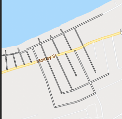
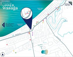
Hi Gurus. I want to recreate the map I attached and one way I can do is I can use the pen tool and trace everything. But its a tedious process.
Map.png

So I used the color range option and tried to select the map thing. But it's not come out properly. Can you tell me where I went wrong with it? Your help and any other methods will be highly appreciated. Thank you.
v3.png
 
Well................there are many options and one would be using the Brush Tool.

Create a new layer.
Double click that layer and open a layer style and set a stroke for 1 pixel, outside, in the color of choice (here I used black).
Any brush stroke applied to this layer will be stoked.

Use the Brush tool with white as your foreground color.
You can adjust the brush size with the bracket keys to fit the size of the road.
Click once with the Brush Tool, move to a new position, hold shift and click again. This creates straight lines.

I did this in about 45 seconds.
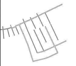
Tracing the existing map (from Google maps)
Screen Shot 2020-08-24 at 10.25.46 AM.png

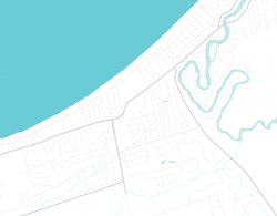
Map layer turned off.
Screen Shot 2020-08-24 at 10.26.02 AM.png

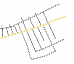
I would repeat the process on a new layer for the large, different colored roads.
Just change the stroke color and the foreground color to match the colors you require.
Screen Shot 2020-08-24 at 10.29.29 AM.png
 
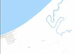
For bodies of water, Color Range works well.

Create a new layer.
Open Color Range.
Select the water color.
Fill the selection with the water color.
Screen Shot 2020-08-24 at 10.38.42 AM.png
 
The best approach would be to get the original image if the effort is not too difficult.
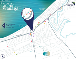
If you must recreate the image as it is, then one approach is to take the image you provided and put it through Gigapixle AI plugin from Topaz. It gets some features pretty well yet some things would need to be redone (numbers in dots an most of the text). Here is the result with a 4X increase in size.
Just one option to consider.
John Wheeler
Upper-wasaga-through-Gigapixel.jpg
 
Well................there are many options and one would be using the Brush Tool.

Create a new layer.
Double click that layer and open a layer style and set a stroke for 1 pixel, outside, in the color of choice (here I used black).
Any brush stroke applied to this layer will be stoked.

Use the Brush tool with white as your foreground color.
You can adjust the brush size with the bracket keys to fit the size of the road.
Click once with the Brush Tool, move to a new position, hold shift and click again. This creates straight lines.

I did this in about 45 seconds.
Tracing the existing map (from Google maps)
View attachment 114811

Map layer turned off.
View attachment 114812

I would repeat the process on a new layer for the large, different colored roads.
Just change the stroke color and the foreground color to match the colors you require.
View attachment 114813

First of all sorry for the delayed reply.As I am busy with my studies. And Secondly. It worked awesome for me. You really saved my day. Your method of doing it is much much easier than all the tedious & cumbersome methods like color range and channels. That's why you are a Guru:). Thanks a ton, BTW I found another way by using channels. I selected the most contrasting channel duplicated it and I played with levels etc.. But your way of doing it much much easier and time-consuming and accurate than all the other methods. I really appreciate the help. Kudos !!
 
Last edited:
If you don't have to use the original map, you can also use the vector maps from OSM.
There are various pages that use OSM maps and output the desired map section as vector data (AI, SVG, PDF, ...) in different styles.
map.jpg
 

Back
Top