What's new
Photoshop Gurus Forum

Welcome to Photoshop Gurus forum. Register a free account today to become a member! It's completely free. Once signed in, you'll enjoy an ad-free experience and be able to participate on this site by adding your own topics and posts, as well as connect with other members through your own private inbox!

Manipulating a heightmap


danparker06

Member
Messages
5
Likes
0
Hello all,

I'm in a situation where I need to add something to a monochromatic heightmap. I would like to be able to take a heightmap, draw a line on it and then shade that line based on the shade underneath. The width of the line would be variable and I would like to be able to add or subtract to the shade below by a variable amount. Is this possible within PS? I have very little experience in PS but if there's a will, there's a way!

Thank you for your help!

Dan
 
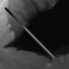
I'm not sure I fully understand the second half of this question but as far as drawing a line and having it 'contrast' with the background this could be done with a 'Line' and an appropriate Blending mode...I've used 'Difference' here...

height_map_MT_01.png

As this is a 'Line', as in a 'Shape' line, its thickness can be changed easily, using the 'End Cap' option also gives you square or rounded ends....just make sure that the 'Stroke' is set to 'Center' first.

Is that somewhere near?

I guess you could always add a 'Gradient Map' layer style if you wanted it coloured.

Regards.
MrToM.
 
Thanks MrTom! I appreciate your help!

This is close to what I want. It looks like what you've done is have the line be the negative of what's below it. What I would like to do it have the line just be slightly lighter (or darker) that what ever is directly below it.

Maybe I should explain more precisely what I'm doing, which might help. This is a heightmap taken from SRTM data available online. I use the heightmap to create a 3D model then carve it into wood with a CNC router. What I want to do is be able to overlay other data (boundaries, roads, trails, etc) and have those lines be raised on the 3D model. I'm sure there are other ways to do this with the modeling software, I'm researching that elsewhere.

Hope that clears things up.

Thanks again!

Dan
 
No worries.

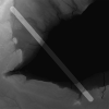
Try different blends modes, my previous example uses 'Difference' but you should experiment with the others....one of them may just do what you want.....like this one that makes everything slightly 'lighter'...

height_map_MT_02.png

And if that's too strong you can always lower the opacity.....many options available.

Regards.
MrToM.
 
...So I'm looking for a 'blending' mode that does what I want...
It should work, yes.

It really depends on what it is you 'overlay' on top your height map. Blending modes will give very different results depending on what it is you 'blend'.

As an example, my first image was a grey (127 RGB) line, the second was white. Each used a different blend mode but had they have used the same mode the result would still be different because of the different colours used.

If your 'roads' or whatever are simply black lines with a transparent background then you will probably find a completely different blend mode would work.

Blend modes are not really predictable as there are just so many variables so its usually a case of getting everything set up and then go through each mode until one fits what you want.

Used with layer opacity you should be able to get a reasonable result.

Regards.
MrToM.
 
I think I found what I'm looking for, albeit using a far simpler method. When you mentioned opacity, it got me thinking.

To test, I just drew a white square on my map, turned the opacity way down (3%) and fed that into the modeling software. Looks exactly like what I want!

Now I just need to figure out how to take my map, add another map, cut out what I don't want, make it white and almost transparent. Good progress though!

Thanks again!
Dan
 

Back
Top